Features
Built for Speed
Meticulously designed by an obsessive hiker for speed and reducing analysis paralysis at each step.
No more twiddling with a hundred filters - just choose the most important parameters, and we do the rest. Get outside faster!
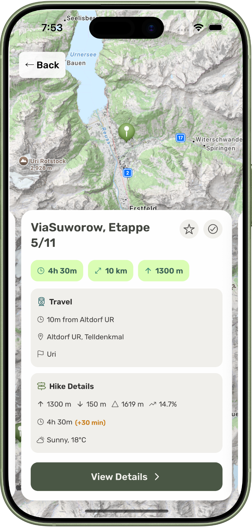
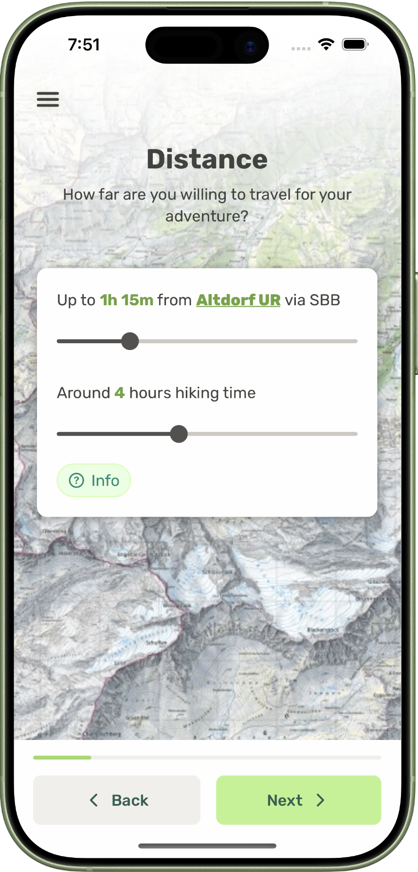
All the logistics via public transport
With an SBB train and Postbus you can get just about anywhere. Each trail is reachable - from both ends - by public transport.
Just enter in how long you want to be on the train for.
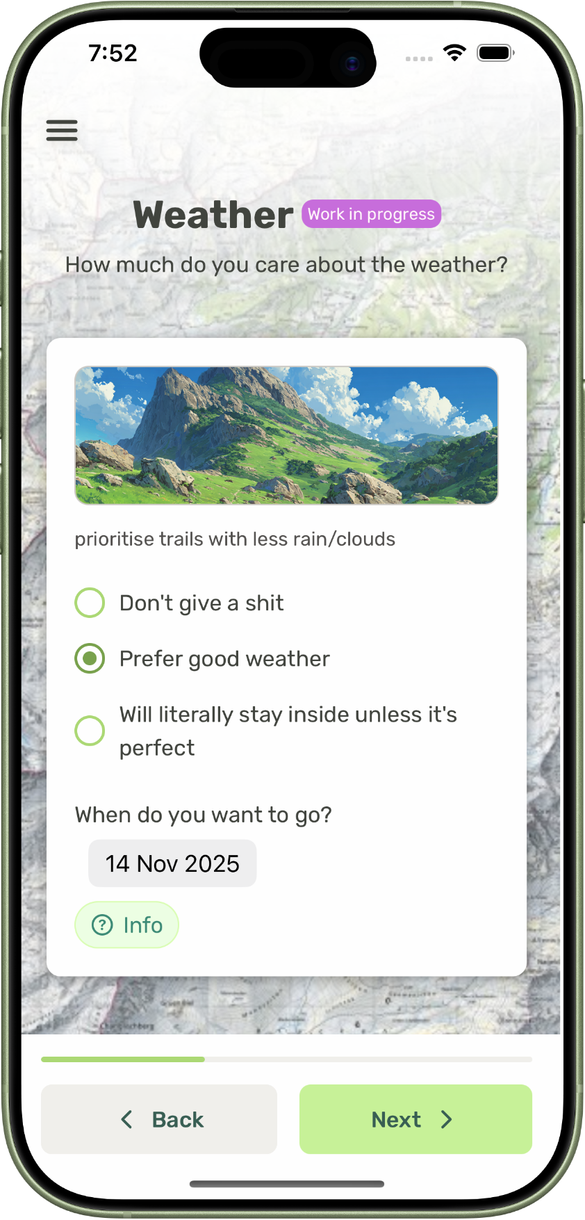
Weather forecast included
Factor in up-to-date weather data from MeteoSwiss (even snow data!) into your planning automatically.
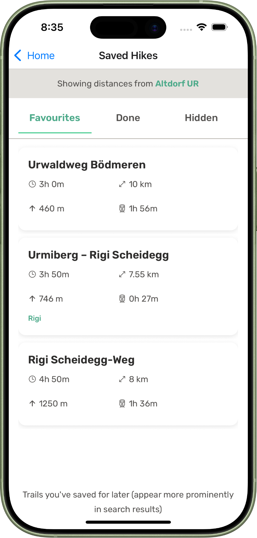
Save your favourites
Found an interesting trail, but maybe a little too far away today? Save it to appear more prominently when you're looking for ideas next weekend.
You can also mark trails as "done" so that they appear less frequently.
And heaps of other features:
Look for something with a steeper ascent and gentler descent
De-prioritize the popular trails with gondolas and busy restaurants